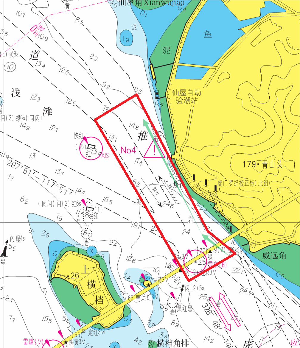
Precise Chart Display
Supports international marine chart formats including S-57, S-63, and S-10X for clear and reliable chart presentation.
Standards compatibleReadable chart featuresStable rendering
 东星海图 · Eastar Map
Product
Make charts visible, readable, and useful in every navigation decision.
Supports international marine chart formats including S-57, S-63, and S-10X for clear and reliable chart presentation.
Standards compatibleReadable chart featuresStable rendering
Keeps vessel position and track status traceable through continuously updated navigation data.
Live positionTrack historyStatus tracking
Helps identify shoals, obstructions, off-course situations, and approaches to hazardous areas before decisions are made.
Active detectionEarly warningReduced omissions
Provides route suggestions by considering speed, tide, weather, and navigation constraints.
Route suggestionsVoyage efficiencyDecision support
Designed for ocean shipping, coastal fishing, inland waterways, port operations, maritime supervision, and yacht cruising.
Multiple vessel typesMultiple watersMultiple scenarios

| Module | Description | Highlights |
|---|---|---|
| Precise Chart Display | Supports international marine chart formats including S-57, S-63, and S-10X for clear and reliable chart presentation. | Standards compatible / Readable chart features / Stable rendering |
| Real-Time Positioning and Track | Keeps vessel position and track status traceable through continuously updated navigation data. | Live position / Track history / Status tracking |
| Intelligent Risk Warning | Helps identify shoals, obstructions, off-course situations, and approaches to hazardous areas before decisions are made. | Active detection / Early warning / Reduced omissions |
| Efficient Route Planning | Provides route suggestions by considering speed, tide, weather, and navigation constraints. | Route suggestions / Voyage efficiency / Decision support |
| Multi-Scenario Fit | Designed for ocean shipping, coastal fishing, inland waterways, port operations, maritime supervision, and yacht cruising. | Multiple vessel types / Multiple waters / Multiple scenarios |
The Eastar Map navigation warning system is a decision-support tool. Its information and suggestions do not replace professional judgment or statutory navigation responsibilities.
Stars above. Seas ahead.